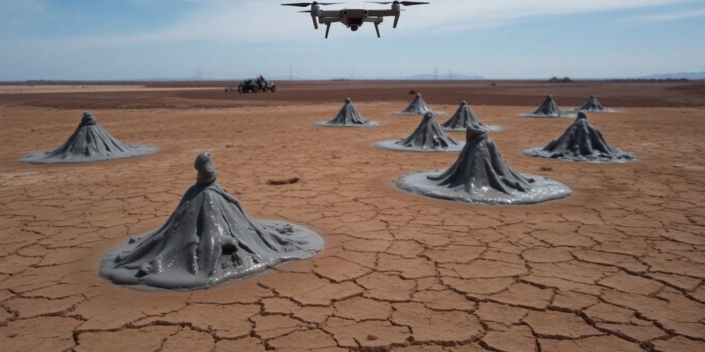
Romania’s unique Mud Volcanoes, a popular tourist destination in Buzău County, have recently undergone a detailed scientific investigation using advanced drone technology. This cutting-edge study aims to deepen the understanding of the geological formations and assess potential risks associated with the area.
Unveiling the Subsurface Secrets
Experts from the National Institute for Earth Physics Research and Development (INFP), in collaboration with Skyline Drones and SPH Engineering, deployed drones equipped with a suite of sophisticated sensors. These included LiDAR technology for precise topographical mapping, ground-penetrating radars to visualize underground structures, magnetometers to detect magnetic anomalies, thermal cameras to monitor temperature variations, and gas sensors to analyze emissions. This comprehensive data collection effort is part of the GeoEduLab initiative, which integrates research, education, and geological risk prevention.
Mission Objectives and Future Implications
The primary goals of this mission were to decipher the hidden structural complexities of the often unstable terrain, monitor the release of gases from the mud vents, and pinpoint areas particularly vulnerable to landslides. The collected data will serve as a crucial resource for future research projects and enhance the understanding of the inherent risks in the region. Researchers also highlighted that while the Mud Volcanoes are a well-known attraction, they remain surprisingly understudied from a scientific perspective. The methodologies employed in this study are expected to be replicable in other areas facing seismic or geological challenges, potentially advancing risk assessment globally. This initiative builds upon previous work, including a 3D subsurface mapping of a mud volcano conducted last year using FullWaver equipment.
Key Takeaways
- Advanced drone technology, including LiDAR and ground-penetrating radar, was utilized to scan Romania’s Mud Volcanoes.
- The study aims to understand the soil structure, monitor gas emissions, and identify landslide-prone areas.
- The research is part of the GeoEduLab initiative, combining scientific investigation with educational and risk prevention goals.
- The findings will contribute to a better understanding of the geological risks associated with the area and can be applied to other geologically unstable regions.
Sources
- Romania’s Mud Volcanoes scanned by cutting-edge drones in new study, Romania Insider.


